
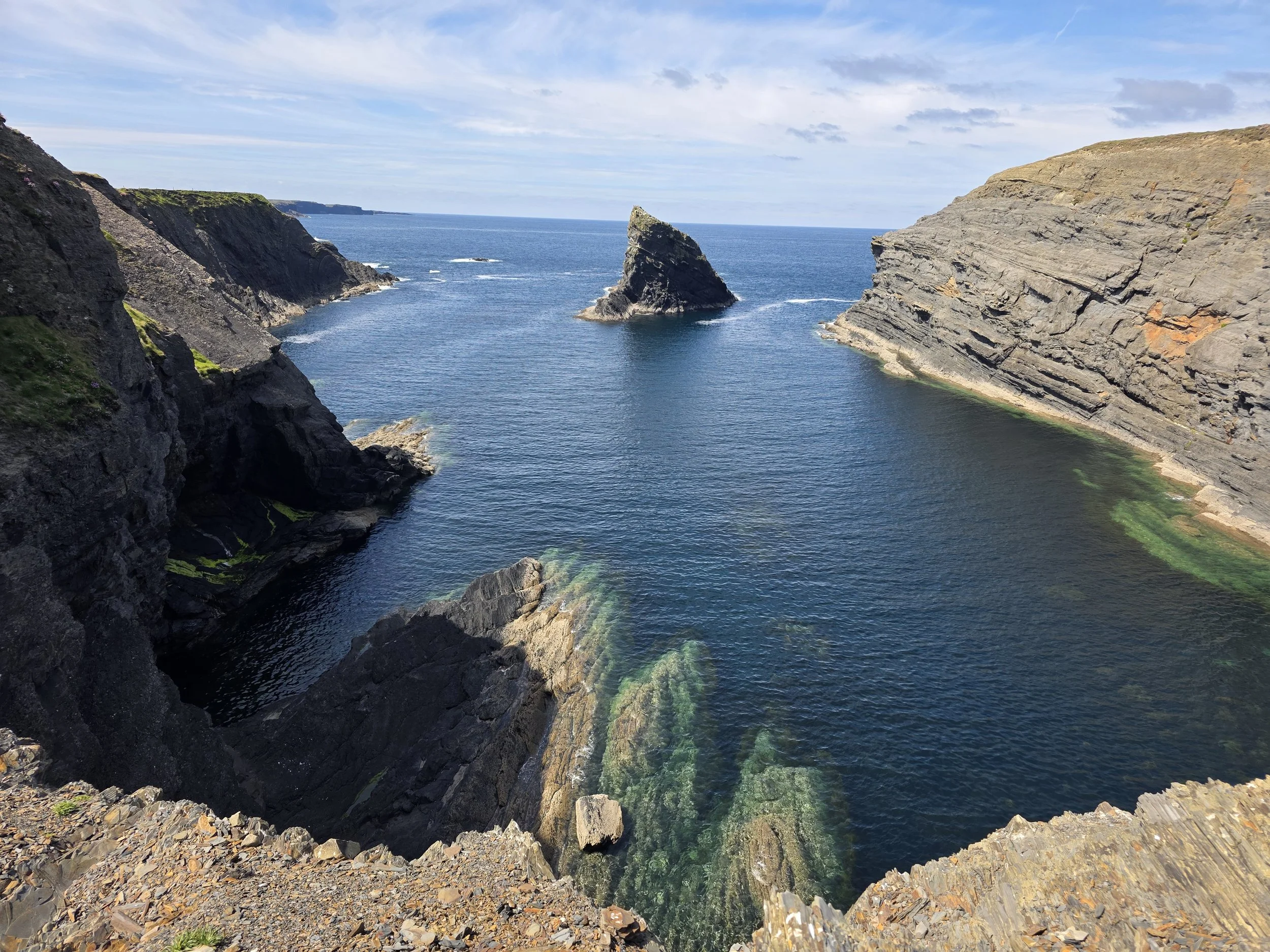
Bridges of Ross, Ireland
The Bridges of Ross are coastal erosional landforms carved into the Upper Carboniferous (Namurian Stage) Ross Formation, which serves as a globally significant outcrop analogue for deep-water clastic systems. The formation comprises a thick succession of interbedded turbiditic sandstones, siltstones, and hemipelagic shales deposited within the tectonically active Shannon Basin. Geologically, it is interpreted as a sand-rich, channel-levee and lobe submarine fan system. The resistant, cliff-forming sandstone units represent the deposits of high-density turbidity currents within channel axes and depositional lobes. These sandstones commonly display well-developed sedimentary structures, including fining-upward Bouma sequences, erosive basal contacts with sole marks (flute and groove casts), and post-depositional dewatering features such as dish-and-pillar structures.
A primary characteristic of the Ross Formation exposed at this locality is large-scale, syn-sedimentary soft-sediment deformation. The prominent folding and contorted bedding are not primarily tectonic but are manifestations of mass-transport deposits (MTDs), where semi-lithified strata failed and moved downslope in a series of slumps and slides. These features, collectively known as the Ross Slide, are associated with fluid-escape structures, including classic sand volcanoes on the upper surfaces of mobilized beds, indicative of high pore-fluid pressures during deposition and deformation. The entire sequence was subsequently deformed by compressional stresses during the late Paleozoic Variscan Orogeny, which created regional-scale folds and brittle fractures. The modern geomorphology of the Bridges of Ross is a direct result of differential marine erosion exploiting these pre-existing lithological and structural heterogeneities—namely, the contrast between resistant sandstones and erodible shales, as well as the joint and fault patterns inherited from Variscan tectonism.
Commercial & Energy Implications
The geological characteristics of the Ross Formation have significant commercial implications, primarily serving as a world-class outcrop analogue for subsurface energy systems.
Oil and Gas: The channelized and lobate turbidite sandstones of the Ross Formation are direct analogues for deep-water hydrocarbon reservoirs found in basins worldwide, such as the Gulf of Mexico, the North Sea, and West Africa. Studying the outcrop allows geoscientists to understand reservoir body geometry, connectivity, and heterogeneity, which are critical factors for predicting hydrocarbon flow and optimizing production. The interbedded shales serve as analogues for the seals and source rocks that trap and generate hydrocarbons in these systems.
Carbon Storage (CCUS): The same properties that make the Ross sandstones potential hydrocarbon reservoirs also make their subsurface equivalents promising targets for Carbon Capture, Utilization, and Storage (CCUS). The high porosity of the sandstones provides the necessary pore volume to inject and store vast quantities of CO₂, while the overlying, low-permeability shales can act as a caprock or seal, ensuring the long-term, safe containment of the gas and preventing its migration to the surface. Understanding the integrity of these seals and potential fault-related leakage pathways is a key area of research for which the Ross Formation provides valuable insights.
Geothermal Energy: The application for geothermal energy is more conditional. While the sandstone bodies possess the requisite permeability to function as geothermal aquifers, a viable system also requires a significant heat source at depth. If subsurface equivalents of the Ross Formation are present in an area with a high geothermal gradient (e.g., near deep-seated granitic intrusions or in tectonically active rift zones), they could host low-to-medium enthalpy geothermal resources, where water could be circulated through the permeable sandstones to extract heat.
Videos from the field
Foundational and Broad Overview Papers
These papers provide the essential context and a comprehensive overview of the Ross Formation and its setting.
Rider, M. H. (1974). The Namurian of West County Clare. Proceedings of the Royal Irish Academy. Section B: Biological, Geological, and Chemical Science, 74, 125-142.
Why it's essential: This is the foundational paper that first established the deep-water turbidite origin of the Ross Sandstone, making it a critical starting point for understanding the area's geology.
Martinsen, O. J., Pyles, D. R., & Haughton, P. D. W. (2017). The Late Carboniferous Ross Sandstone of Western Ireland: Deepwater Insights from Behind Outcrop Drilling. In: Deepwater Sedimentary Systems, 3-29.
Why it's essential: This provides a modern synthesis, incorporating new data from drilling behind the outcrop to offer a three-dimensional perspective of the geological structures you see on the coast.
Sedimentology and Stratigraphy
These articles focus on the specific sedimentary processes and the resulting rock layers and structures that form the cliffs.
Pyles, D. R. (2008). Multiscale stratigraphic analysis of a structurally confined submarine fan, Carboniferous Ross Sandstone, Ireland. AAPG Bulletin, 92(5), 557-587.
Why it's essential: This paper gives a detailed architectural analysis of the Ross Sandstone, interpreting it as a submarine fan system confined by underwater topography, which is key to understanding the sediment distribution.
Elliott, T. (2000). Depositional architecture of a sand-rich, channelized turbidite system: the Upper Carboniferous Ross Formation, western Ireland. In Atlas of Deepwater Outcrops (pp. 144-151). AAPG Studies in Geology 47.
Why it's essential: It provides a clear description of the sand-rich, channel-like features within the turbidite system, which are a fundamental building block of the Ross Formation.
Structural Geology and Tectonics
These papers investigate the deformation of the rock layers, both while the sediments were soft and later by major tectonic forces.
Martinsen, O. J., & Bakken, B. (1990). Extensional and compressional zones in slumps and slides in the Namurian of County Clare, Ireland. Journal of the Geological Society, 147(1), 153-164.
Why it's essential: The spectacular folded and contorted layers visible at the Bridges of Ross are examples of ancient submarine landslides (slumps and slides). This paper explains the mechanics behind their formation.
Gill, W. D., & Kuenen, P. H. (1958). Sand volcanoes on slumps in the Carboniferous of County Clare, Ireland. Quarterly Journal of the Geological Society, 113(1-4), 441-460.
Why it's essential: This is the classic, original paper describing the fascinating "sand volcano" structures found on the bedding planes in the area. These features provide a unique window into soft-sediment deformation and fluid escape processes.